Novel Integrated Lunar Mapping Model

Knowledge Transfer
An innovative lunar mapping model has been developed for high-precision lunar topographic mapping by integrating cross-mission cross-sensor remote sensing datasets. Essential for proper calibration, registration, and analysis of multi-source lunar topographic datasets collected from different missions, the new model enables the full comparative and synergistic use of them.
By integrating multi-platform satellite/ aerial imagery and laser scanning data for 3D mapping, the new model has greatly reduced inconsistencies among different datasets and improved the mapping accuracy.
Contributing to the advancement of planetary mapping and scientific research, it was cited by Nature Index as a landmark in lunar topographic models. The mapping model has been used for landing site mapping and selection of the Chinese Chang’E-3 and Chang’E-5 lunar landing missions.
The research team led by Dr Bo Wu won a Gold Medal and a Special Merit Award at the 44th International Exhibition of Inventions of Geneva in April 2016. The team also won the First Honorable Mention of the 2016 Talbert Abrams Award by the American Society for Photogrammetry and Remote Sensing (ASPRS) in 2016.
Research students are working on the satellite image processing of the Chang’E-3 landing area
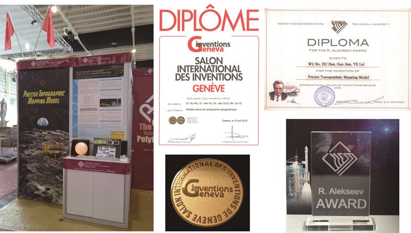
The development won a Gold Medal and a Special Merit Award at the 44th International Exhibition of Inventions of Geneva in April 2016

We use Cookies to give you a better experience on our website. By continuing to browse the site without changing your privacy settings, you are consenting to our use of Cookies. For more information, please see our Privacy Policy Statement.
Your browser is not the latest version. If you continue to browse our website, Some pages may not function properly.
You are recommended to upgrade to a newer version or switch to a different browser. A list of the web browsers that we support can be found here
