New Technology for Remote Monitoring of the Environment and Hazards

Knowledge Transfer
Environmental change and geohazards often have drastic impacts on our society. Better understanding of the problems, and developing effective technologies to detect the precursors of emergent situations can help mitigate the problems and reduce their impacts. A group of LSGI researchers, including Prof. Xiaoli Ding, Prof. Janet Nichol, Dr Zhizhao Liu, Dr Charles Wong, Dr Wallace Lai, and Dr Lei Zhang has developed advanced satellite and ground-based remote sensing technologies to study the environment, geohazards and problems in urban infrastructure (including underground infrastructure). Their research has led to both new discoveries and technological advancements.
The technologies have been used widely in Hong Kong and internationally, contributing to a healthier and safer living environment. For example, technologies for mapping the effects of urban air quality and heat islands have been transferred to the Hong Kong government’s Planning Department, Lands Department, as well as the Hong Kong Observatory. The GNSS (Global Navigation Satellite Systems) deformation monitoring technology has also been used widely in several countries for monitoring landslides and structural safety. A multi-antenna GNSS technology has become an industry standard for monitoring landslides and structural safety.
A number of awards have been received, including the 1st Prize of the Natural Science Award from the Ministry of Education in China in 2014.
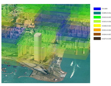
Vertical profile of aerosol concentrations over southwest Kowloon from MODIS satellite images
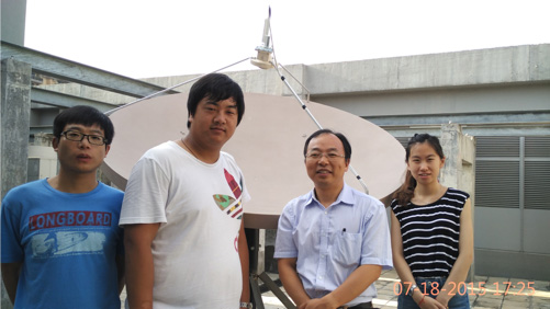
Advanced remote sensing satellite data receiving station at HK PolyU

We use Cookies to give you a better experience on our website. By continuing to browse the site without changing your privacy settings, you are consenting to our use of Cookies. For more information, please see our Privacy Policy Statement.
Your browser is not the latest version. If you continue to browse our website, Some pages may not function properly.
You are recommended to upgrade to a newer version or switch to a different browser. A list of the web browsers that we support can be found here