Skip to main content Start main content

Digital Cartography Laboratory (ZS1001)

cartolab_

Like ZN604, ZS1001 is equipped with 50 assembly workstations of the same model. These workstations are also installed with Microsoft Windows 11 Enterprise Version 23H2 and the same surveying and geomatics application software suite as in ZN604, to be used for general teaching and learning in the department.  

Research Publications

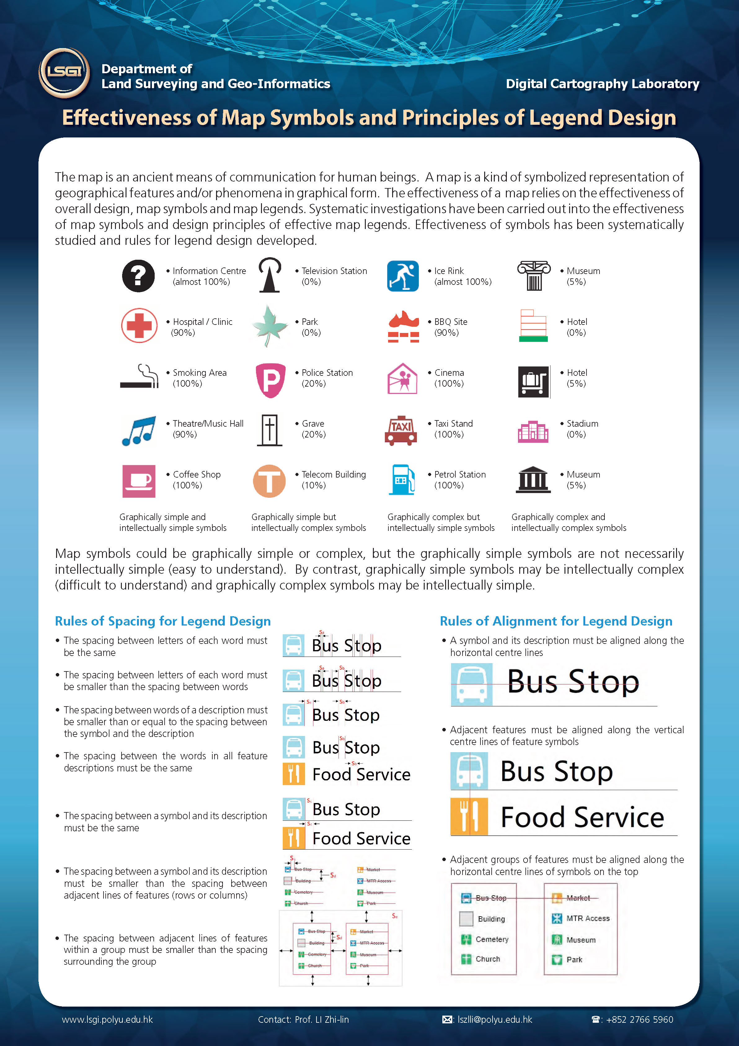
Effectiveness of Map Symbols and Principles of Legend Design

THe mapo is an ancient means of communication for human beings. A map is a kind of symbolized representation of geographical features and/or phenomena in graphical form. The effectiveness of a map relies on the effectiveness of overall design, map symbols and map legends. Systematics investigations have been carried out into the effectiveness of map symbols and design principles of effectiveness map legends. Effectiveness of symbols has been systematically studied and rules for legend design developed.

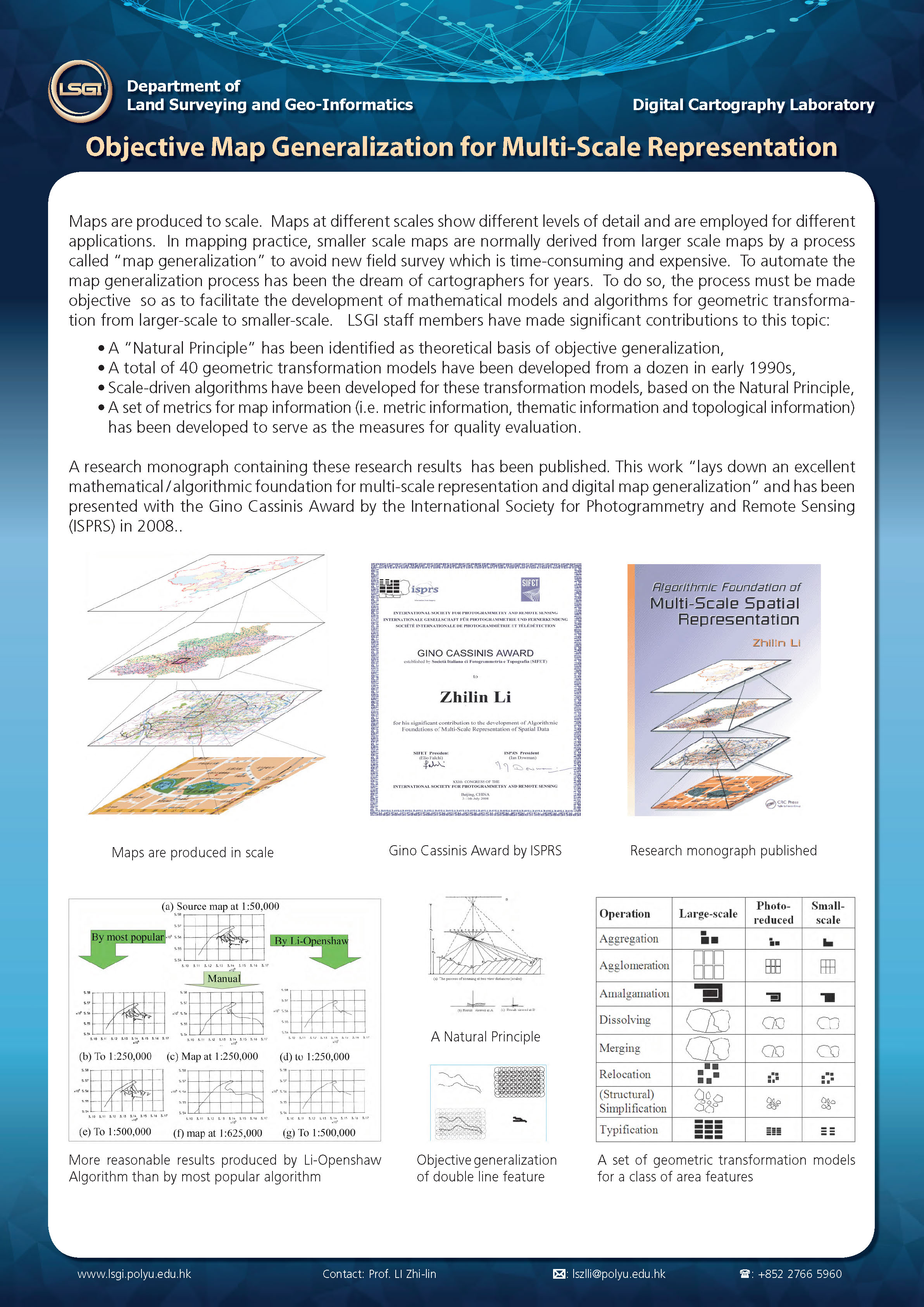
Objective Map Generalization for Multi-Scale Representation

Maps are produced to scale. Maps at different scales show different levels of detail and are employed for different applications. In mapping practice, smaller scale maps are normally derived from larger scale maps by a process called "map generalization" to avoid new field survey which is time-consumming and expensive. To automate the map generalization process has been the dream of cartographers for years. To do so, the process must be made objective to so as to facilitate the development of mathematical models and algoritms for geometric transformation from larger-scale to smaller-scale.

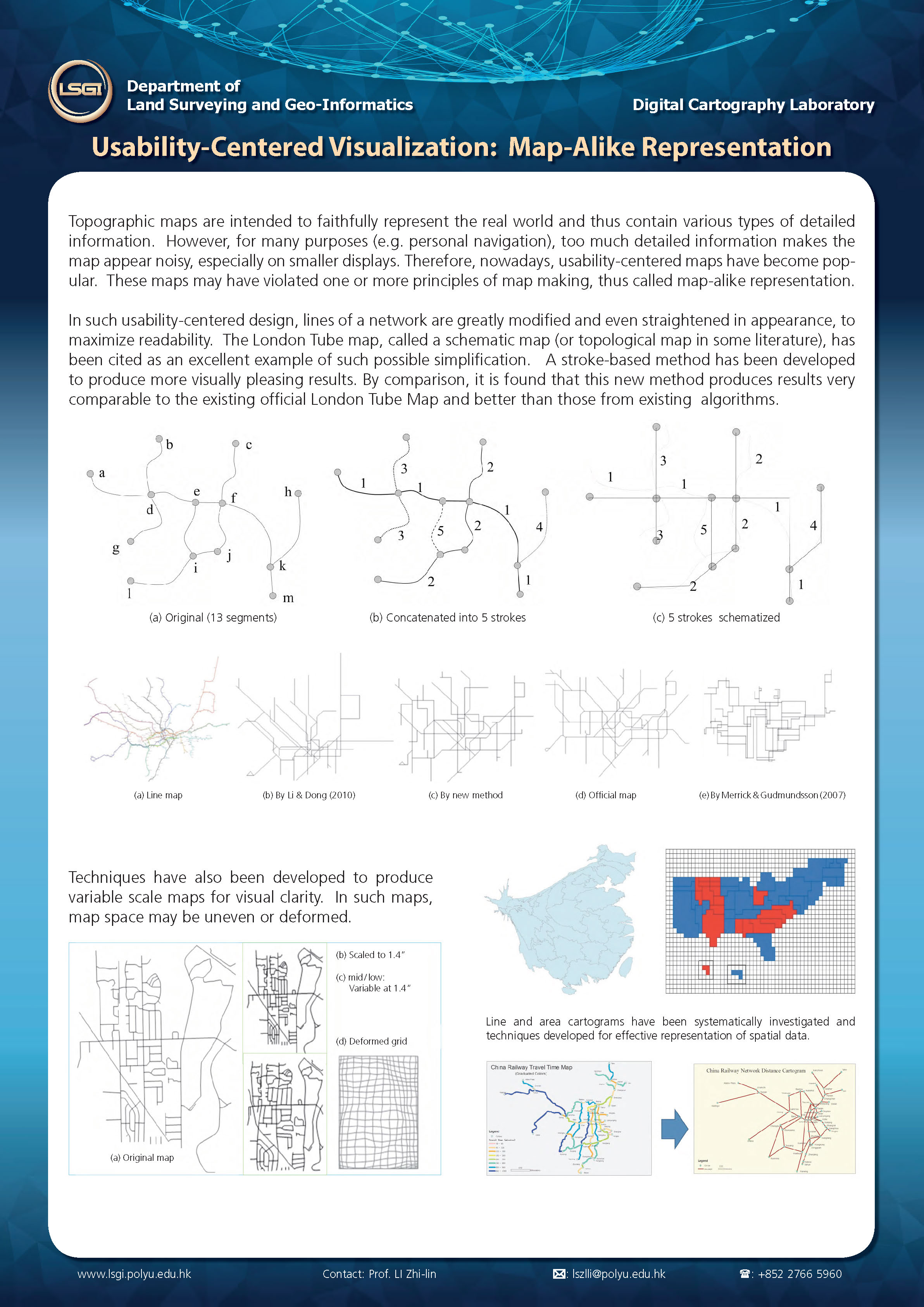
Usability-Centered Visualization: Map-Alike Representation

Topographic maps are intended to faithfully represent the real world and thus contain various types of detailed information. However, for many purposes (e.g. personal navigation), too much detailed information makes the map appear noisy, especially on smaller displays. Therefore, nowadays, usability-centered maps have become popular. These maps may have violated one or more principles of map making, thus called map-alike representation.

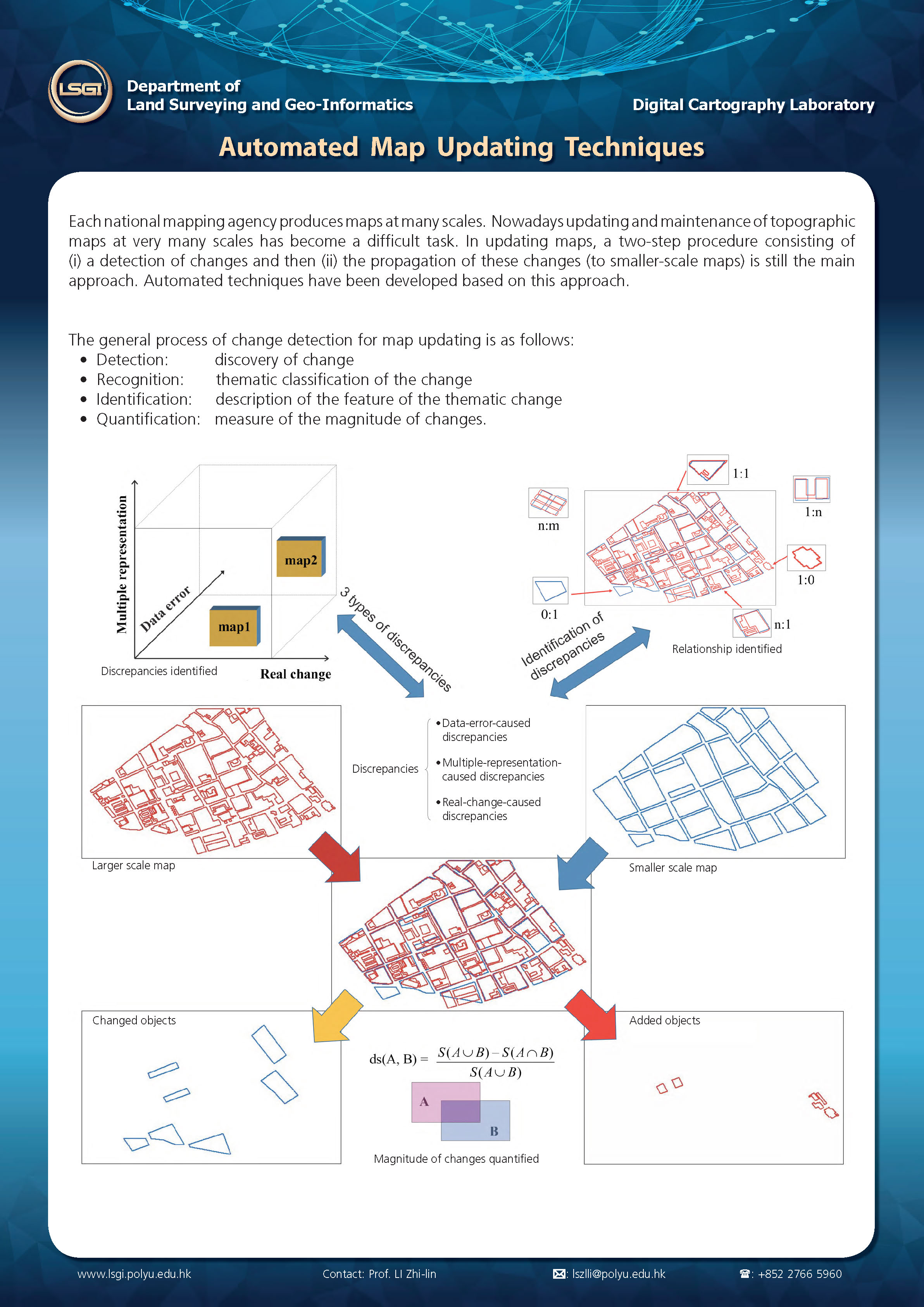
Automated Map Updating Techniques

Each national mapping agency produces maps at many scales. Nowadays updating and maintenance of topographic maps at very many scales has become a difficult task. In updating maps, a two-step procedure consisting of (i) a detection of changes and then(ii) the propagation of these changes (to smaller-scale maps) is still the main approach. Automated techniques have been developed based on this approach.

Publication Item

testing

Your browser is not the latest version. If you continue to browse our website, Some pages may not function properly.

You are recommended to upgrade to a newer version or switch to a different browser. A list of the web browsers that we support can be found here