

Faculty of Construction and Environment
CODE
34480-SYL
ENTRY

Sept 2027 Entry

STUDY MODE
Full-time
DURATION

2 years

CREDIT REQUIRED

BSc (Hons) in Land Surveying and Geo-Informatics

  • 60 (Plus 1-credit industrial safety training and a non-credit bearing summer training)
PROGRAMME INTAKE
24 senior year places
FUND TYPE
Government-Funded
  • The curriculum of this programme, including the credit requirements, is subject to review.

  • The exact study duration and number of credits to be transferred will depend on the entry qualification of individual AD/HD admittees. Holders of a surveying or computing related Higher Diploma or Associate Degree may be given credit transfers for relevant subjects.

Application Deadline
Non-JUPAS Local Senior Year Admissions
2026-11-17

What's New

More News

PolyU Info Day 2026
  • Undergraduate
PolyU InfoDay: 10 Oct 2026, 10:00–17:00. Register now — your future starts here!
JUPAS Score Calculator
  • Undergraduate
JUPAS Score Calculator for 2027/28 is now available
About Programme
Specific Notes
How to Apply
Aims & Characteristics

Programme Aims and Learning Outcomes

The programme is underpinned by the philosophy that our graduates should be capable of coping with the rapidly changing market conditions in Hong Kong, Chinese mainland and the region, and with the demands of their future professions in land surveying, geo-information technology, utility management and surveying. The Department has close links with professional bodies and invites industry experts to give guest lectures to students whenever appropriate.


The aims of the programme are to:

  • provide a land surveying education that meets the requirements of Hong Kong and overseas professional bodies; and

  • equip students with geo-information technology and utility management skills, enabling graduates to work competently and confidently as geographic information systems professionals in disciplines such as transport and logistics, and environmental, socio-economic, commercial and construction surveying; or as utility professionals in a discipline related to the survey, condition diagnosis, maintenance and management of underground facilities.


Upon completion of the programme, students will be able to:

  • apply appropriate mathematical and computing skills to solve problems and analyse data;

  • comprehend and apply geomatics concepts and theories;

  • understand geomatics technologies and apply them appropriately;

  • integrate various geomatics technologies to solve problems in a professional, timely and cost effective manner;

  • carry out and manage geomatics projects;

  • work with and supervise others in accordance with, and abiding by, society’s legal, ethical and professional standards; and

  • respond to advancements in geomatics and related technologies as part of their continuous, lifelong learning.

Recognition & Prospects

Professional Recognition

The BSc (Hons) in Land Surveying and Geo-Informatics programme is accredited by The Hong Kong Institute of Surveyors (HKIS), the Royal Institution of Chartered Surveyors (RICS), The Malaysia Land Surveyors Board (LJT), The Land Surveyors Board of Singapore (LSB), the Chartered Institution of Civil Engineering Surveyors (CICES) and The Hong Kong Institution of Engineering Surveyors (HKInstES).

(Subject to regular re-accreditation)


Career Prospects

Graduates of BSc (Hons) in Land Surveying and Geo-Informatics can become professional land surveyors, geo-information technology specialists or utility specialists.


Curriculum

The programme curriculum enables students to develop all-round skills and to be ready for professional careers through subjects related to the land/utility surveying and geo-informatics industry and subjects related to languages, ethics and global engagement. Compulsory subjects are offered every year and in progressive patterns, whereas a group of elective subjects are offered. This combination of compulsory and elective subjects equips students with the knowledge and skills needed to comprehend basic and advanced technologies. These include basic surveying, positioning and navigation skills and advanced 3D mapping, modelling, visualisation skills related to the analysis of terrain, infrastructure, buildings, underwater environments, the underground world and even other planets, with emphases changing over time. Graduates are equipped with the highest caliber to pursue professional career and further education upon the two years of study.
 

More information on the curriculum and subjects offered can be found here.

Credit Required for Graduation

BSc (Hons) in Land Surveying and Geo-Informatics

  • 60 (Plus 1-credit industrial safety training and a non-credit bearing summer training)
Scheme/Programme Leader(s)

Programme Leader of BSc (Hons) in Land Surveying and Geo-Informatics 

Prof. ZHU Xiaolin 
BSc, MSc, PhD
 

Deputy Programme Leader of BSc (Hons) in Land Surveying and Geo-Informatics

Prof. SHI Guoqiang 
PhD


Dr CHEN Si, Sissi 
BA, BSc, MSc, PhD


Entrance Requirements

Applicants with Higher Diploma or Associate Degree in relevant discipline areas such as

  • Higher Diploma in Geomatics or Land Surveying and Geo-Informatics,

  • Higher Diploma in Geospatial Science and Land Surveying,

  • Associate Degree in Engineering, 

  • Associate Degree in Information Technology, 

  • Associate Degree in Surveying and Built Environment,

or the equivalent.

Enquiries

For further programme information, please contact:

The General Office (tel.: 3400 3664; email: lsgs.ug@polyu.edu.hk).
Student Message

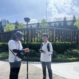
Studying at the Department of Land Surveying and Geospatial Science (LSGS) at The Hong Kong Polytechnic University has been one of the most rewarding journeys of my life. During my studies, I have gained extensive experience in land surveying, GIS, and urban informatics through numerous laboratory classes and survey camps, equipping me with the professional knowledge needed to keep pace with our ever-changing society. This helped develop my technical skills, analytical thinking, and cooperation with peers. 

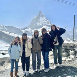
Apart from these, I participated in study tours to Japan and Sweden, which provided me with insight into the applications of spatial data in solving urban and environmental problems, including underground utilities management in cities. Each environment offers unique knowledge.

Last but not least, I have made lasting friendships and developed the confidence to enter this fast-growing profession. As a graduate of LSGS, I gained professional knowledge and qualifications and was encouraged to work towards the sustainable development of our society.

I highly encourage prospective students passionate about spatial data and technology to join LSGS — it will transform your future.

CHU Wing Wai (graduate of BSc (Hons) in Land Surveying and Geo-Informatics in 2026)

Studying on the BSc (Hons) in Land Surveying and Geo-Informatics programme at PolyU has given me a wealth of career and academic opportunities. Trading a semester at PolyU for a semester at KTH Royal Institute of Technology in Stockholm, Sweden was likely the most notable opportunity I had. KTH has a stellar academic reputation, and I was able to take graduate-level coursework on Global Navigation Satellite Systems (GNSS) and on Spatial Analysis & Geoinformatics. This opportunity expanded my mastery of modern surveying tools as well as my ability to model different phenomena and analyse data. It also expanded my ability to think critically about different frameworks and methodological approaches and consider how they might apply in the context of my country.

Not only did the LSGS offer great exchange opportunities to Europe, but they also provided subsidised International Study electives that opened doors to land surveying work abroad. On a trip to Japan, I saw how surveying and GIS helped with both the preservation of cultural heritage at the Osaka Museum of History and the management of temple-goers at Kiyomizu-dera.

There was an excellent connection with industry through this bachelor's programme. During my Work Integrated Education (WIE) placement with the Civil Engineering and Development Department, I conducted UAV surveys, participated in hydrographic surveys, and performed 3D surveying and laser scanning. Because of these experiences, I was able to see the innovative aspects of LSGS and the multitude of career opportunities that it offers.

With the combination of advanced surveying skills, an international perspective, and the confidence to tackle challenges, this programme prepares you for the ever-changing surveying and geo-informatics industry. 

I recommend this programme to any future students who want to build a solid foundation and stand out in the field.

WONG Yeuk Mei (graduate of BSc (Hons) in Land Surveying and Geo-Informatics in 2026)

My favourite courses at LSGS have been those with substantial programming components and geospatial technologies. For me, programming becomes more interesting when applied to real-world tasks. When integrated with geospatial data, it seems even more fascinating to learn how to apply innovative data-gathering techniques, such as laser scanning and 3D point cloud data.

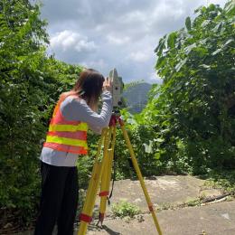
The workflow I learned is highly practical. Throughout my studies, I have developed strong skills in spatial data analysis, visualisation, and using code to solve complex geographic problems. I like conducting field surveys using modern technology, analysing the data, and using ArcGIS Pro to digitally map surveyed physical features. During my internship at the Lands Department, I expanded on this by working with unmanned aerial vehicle (UAV) photogrammetry, processing drone data to construct 3D maps. Transitioning from university studies to the workplace feels natural and straightforward, thanks to the training provided by LSGS courses. I also really like cartography and setting out map features back into the real world.

Studying at LSGS opens up many career paths in Hong Kong, from governmental departments to private companies. If you are interested in geospatial technology and practical geography, LSGS is a perfect choice.

YIP Chik Him (graduate of BSc (Hons) in Land Surveying and Geo-Informatics in 2026)
Additional Documents Required
Transcript / Certificate

Required

Interview Arrangement
Aims

To evaluate the potential and interest of applicants in the programme, and to assess their language and communication skills and understanding of the industry.

Date of Interview
Between December and July
Duration

About 20 minutes

Medium
English
Mode
Group interview
Remarks

Suitable applicants may be invited to attend an interview.