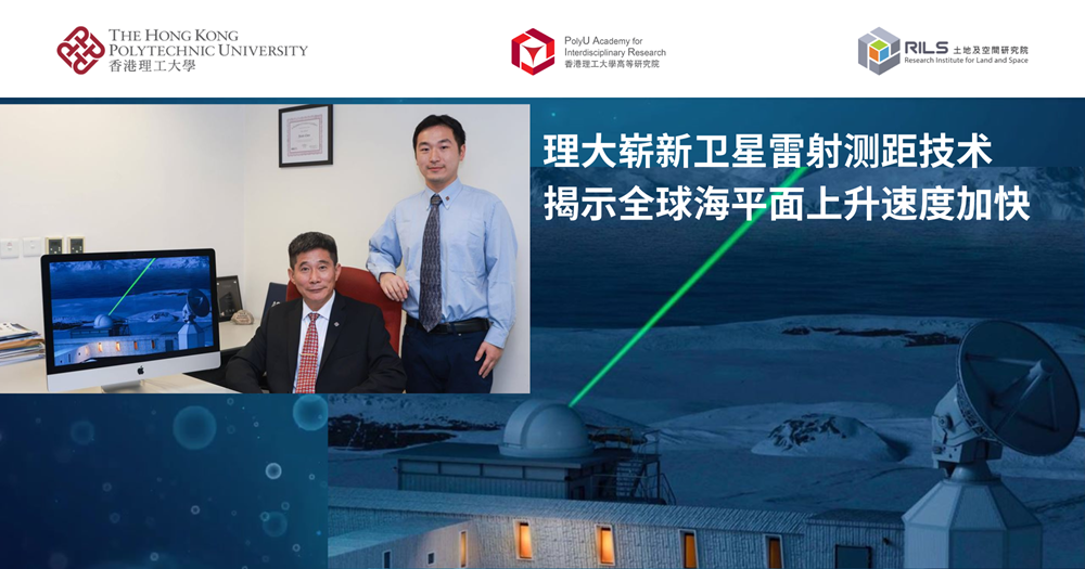
A research team led by Prof. CHEN Jianli, Core Member of Research Institute for Land and Space (RILS) and Chair Professor of Space Geodesy and Earth Sciences, has utilised advanced space geodetic technologies to deliver the first precise 30-year (1993–2022) record of global ocean mass change (also known as barystatic sea level), revealing its dominant role in driving global mean sea-level (GMSL) rise. Their research further indicates that GMSL has been increasing at an average rate of approximately 3.3 mm per year with a notable acceleration observed, highlighting the growing severity of climate change. The research findings have been published in the Proceedings of the National Academy of Sciences, with Dr NIE Yufeng, a Research Assistant Professor in Prof. CHEN’s team being the lead author.
GMSL is primarily driven by two factors: the thermal expansion of seawater, as the oceans absorb around 90% of the excess heat in the Earth’s climate system; and the increase in global ocean mass, which is mainly caused by the influx of freshwater from melting land ice. Therefore, long-term monitoring of global ocean mass change is essential for understanding present-day GMSL rise.
In the past, scientists have relied on long-term observations from satellite altimetry to monitor sea-level rise. Barystatic sea level records based on satellite gravimetry only became available with the launch of the Gravity Recovery and Climate Experiment in 2002. SLR is a traditional space geodetic technique used to accurately measure the distance between satellites and ground stations via laser ranging. However, fundamental constraints of SLR, such as the limited number of satellites and ground stations, the high altitude of the satellites (which means SLR-derived gravitational changes capture only the longest wavelengths) and the low-degree gravitational measurements, have restricted its direct application in estimating ocean mass change
To effectively utilise SLR-derived gravitational fields for accurate estimates of ocean mass change, the research team implemented an innovative forward modelling technique that tackles spatial resolution limitations by incorporating detailed geographic information of ocean-land boundaries. This approach enables long-term monitoring of global ocean mass changes
The research revealed that an increased rate of GMSL resulted in a global average sea-level rise of approximately 90 mm between 1993 and 2022, with about 60% of this rise attributable to ocean mass increase. Since around 2005, the rise in GMSL has been primarily driven by the rapid increase in global ocean mass. This overall increase is largely driven by the accelerated melting of land ice, particularly in Greenland. Throughout the entire study period, land ice melt from polar ice sheets and mountain glaciers accounted for over 80% of the total increase in global ocean mass.
Press release: https://polyu.me/4g6ioDd
Online coverage:
wn.com - https://polyu.me/45YB4jj
Mirage News - https://polyu.me/46iGlni
Oriental Daily News - http://polyu.me/4lV48hJ
Ta Kung Pao - https://polyu.me/4n9KAXN
Hong Kong Commercial Daily - https://polyu.me/47XmMC9
Line Today - https://polyu.me/3JZcVSo
hkong.hk - https://polyu.me/4m5iLPO
CCTV - http://polyu.me/4n9SYGQ
Wuxi Daily - https://polyu.me/4n7EAPg
Technology Networks - https://polyu.me/45Z6SVo
Beijing-Hong Kong Academic Exchange Centre - https://polyu.me/4oYTadL
Zhuhai Net - https://polyu.me/4mMXpYz
Medium - https://polyu.me/4272D8X
Guangzhou Daily - https://polyu.me/4p2SZ16
Nanfang Daily - https://polyu.me/4p5N3V2
Research Units | Research Institute for Land and Space |
---|
You may also like