Skip to main content Start main content

News

News banner
SCI Journal

Publication of SCI Journal Paper by AE Students with Their FYP

【Publication of SCI Journal Paper by AE Students with Their FYP】 
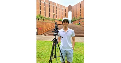
Mr Max Jwo Lem Lee and Mr Shang Lee, a final-year undergraduate studying Aviation Engineering and recent graduate from the Aviation Engineering Program, respectively, have published their first academic paper in the Sensors peer reviewed journal under the supervision of Assistant Professor Li-Ta Hsu and MSc student Hoi-Fung Ng.  Titled “Skymask Matching Aided Positioning Using Sky-Pointing Fisheye Camera and 3D City Model in Urban Canyons”, the paper addresses the problem of GNSS positional inaccuracies in dense urban environments via the usage of a fisheye camera, neural network, and 3D model of the urban environment. After the user takes an image, the sky is identified using the neural network into a skyplot. This skyplot is then compared to skyplot’s generated using the 3D model, and weighted using multiple different methods to determine the improved bearing of the image and the most likely position.   The academic paper is linked below: Lee MJL, Lee S, Ng HF, Hsu, L-T. (2020) Skymask Matching Aided Positioning Using Sky-Pointing Fisheye Camera and 3D City Models in Urban Canyons, Sensors, 20(17):4728. IF: 2.475 (157/601= 26.1% in Electrical and Electronic Engineering)   Sensors 2020, 20(17), 4728; https://doi.org/10.3390/s20174728   The Interdisciplinary Department of Aeronautical and Aviation Engineering would like to extend their congratulations to the authors of the paper.   The graphical abstract is given below. GNSS is a navigation tool that has deeply integrated itself into today’s society. Many activities from logistics to mapping utilise this form of navigation. However, GNSS has proven difficult to use in dense urban areas with many high-rises that can obscure or reflect signals, where positioning error may exceed 50 meters. Considering the proliferation of GNSS receivers integrated into smartphones and recent advances in the field of autonomous driving, accurate positioning is crucial to navigation of urban areas. A myriad of methods has been developed to dampen the severity of this issue, with one of the most notable being 3DMA post-processing techniques. However, these techniques tend to require large amount of computation resources to use. This paper introduces a machine learning intelligent classifier to distinguish between building and sky of a sky-pointing fisheye image, then compares and matches the building boundaries (skymask) with skymasks generated from a 3D model to determine the position of the receiver. In the offline process, skymasks are generated from the 3D model at each available position outside the buildings. After the user captures a fisheye image using a zenith-pointing fisheye camera. This image is segmented into 2 classes (building and sky) by the classifier, allowing comparison to the candidate skymasks surrounding the initial position estimated by the receiver. They are compared using four main scoring systems, by the differences of elevation, standard deviation of the elevation, peaks of the elevation, and heading. In the end, the image that has the highest score is selected as the improved position. Several designed experiments were tested in Hong Kong urban area to evaluate the performance of proposed Skymask Matching method with intelligent classifier. The method proves effective in dense urban environments, being capable of reducing positional uncertainty to a third of the initial position estimated by a smartphone. Venues for further improvement includes introducing more classes to the Classifier and expanding the camera movement to six degrees of freedom.       (Left) A positioning candidates heatmap in a densely urban environment, including the resultant positions of multiple processing techniques; (Right) A sky-pointing fisheye image and its candidate skymask counterpart; (Bottom) A graph displaying the building boundary similarity in azimuth and elevation degrees between the image converted skymask and its candidate skymask.  

29 Sep, 2020

News

AIAA_2020

PolyU’s 3rd Design, Build, and Fly (DBF) Team representing PolyU at American Institute of Aeronautics and Astronautics (AIAA) in Design-Build and Fly Competition

PolyU’s 3rd Design, Build, and Fly (DBF) Team representing PolyU at American Institute of Aeronautics and Astronautics (AIAA) in Design-Build and Fly Competition We are AEOLUS, an RC Aeromodelling Team representing PolyU at American Institute of Aeronautics and Astronautics (AIAA) Design/Build/Fly Competition every year. This contest lets engineering students taste the real-world design experience by providing an opportunity to apply their knowledge practically. The teams are expected to design an unmanned, electric-powered, radio-controlled aircraft that can best achieve the ‘missions’ assigned. The missions and rules will be modified each year to encourage innovation and maintain fresh design challenge for the novel participants. Such a measure ensures the implementation of critical thinking and the originality of the aircraft designed each year. As a team who enjoys evaluating practical aspects of mechanical theories and the laws of physics to understand their real-world applicability, we are strongly attracted to the opportunities provided by the AIAA DBF Competition. Our team has extended knowledge of aircraft technologies, especially in Aerodynamics, Flight Mechanics, Structure, and Material. We see this competition as a perfect platform for us to test our own ideas in manufacturing an RC aircraft in order to make palpable progression in our subject area. Our long-term goal is to develop the most efficient manufacturing methods and techniques as we believe that the real value of competition lies in applying the knowledge to the real-world and benefit mankind.     Email: aiaabdf.aae@connect.polyu.edu.hk   Instagram Page: https://www.instagram.com/aeolus_polyu/ Facebook Page: https://www.facebook.com/aeolus.polyu/ LinkedIn Page: https://www.linkedin.com/company/aeolus-polyu/

16 Sep, 2020

Student Achievement

Simon_1

Two Days University Experience Programme "From Physics and ICT to Engineering"

【Two Days University Experience Programme (Online)】 Ir. Professor Simon Yu represented AAE to join the Two Days University Experience Programme "From Physics and ICT to Engineering".  He delivered an online lecture on Aircraft Force and Motion and shared his research experience.  It was successfully conducted on 4 August 2020.  Participants gained a lot of fundamental aircraft knowledge.

7 Aug, 2020

News

a108_1176x644

Joint laboratory to explore innovation in autonomous vehicles

Excel x Impact - JUN 2020 ISSUE 1 Published by PolyU's Communications and Public Affairs Office

20 Jul, 2020

News

104481297_150009366681246_4726873570216298835_o

ATE alumni WONG Kwok Ting was awarded HKIE LTD Best Student Paper Awards 2018

Our alumni WONG Kwok Ting (ATE) was awarded HKIE LTD Best Student Paper Awards 2018 More details at newly published HKIE LTD Annual Report 2019 http://www.hkie.org.hk/…/an…/Annual%20Report_LT_20200504.pdf (Page 11).

20 Jul, 2020

Student Achievement

97091728_132843011731215_849754877172121600_o

AAE Research Student Won Best Student Paper Award in ION GNSS 2019

AAE Research Student Won Best Student Paper Award in ION GNSS+ 2019 Date: 20 September 2019 Venue: Hyatt Regency Miami, Miami, Florida, U.S. Mr Guohao Zhang, our Research Student supervised by Dr Li-Ta Hsu, won the Student Paper Award for the paper “3D Mapping Aided GNSS-Based Cooperative Positioning Using Factor Graph Optimization” presented at the ION GNSS+ 2019, the 32nd International Technical Meeting of the Satellite Division of the Institute of Navigation on 19 September 2019. There only 4 winners out of all the papers submitted. The improved paper is also accepted and published in IEEE transaction on intelligent transportation systems. https://ieeexplore.ieee.org/abstract/document/9082815 The Satellite Division awarded four students with Student Paper Awards. Recognized industry and academic experts selected winners. (left to right) Alex Minetto, Politecnico di Torino, Italy; Surabhi Guruprasad, York University, Canada; Jiang Guo, Wuhan University, China; and Guohao Zhang, The Hong Kong Polytechnic University, China. ION GNSS+ is the world's largest technical meeting and showcase of GNSS technology, products and services. This year's conference will bring together international leaders in GNSS and related positioning, navigation and timing fields to present new research, introduce new technologies, discuss current policy, demonstrate products and exchange ideas. [1] [1] https://www.ion.org/

20 Jul, 2020

Student Achievement

Max-Lee_20200529

AAE Student Received Boeing/Cathay Pacific/HAESL Internship Programme 2019/2020

Congratulations to Max Lee for receiving the highly competitive Boeing/Cathay Pacific/HAESL internship programme 2019/2020! Max is now undertaking a Boeing engineering internship in the Seat Integration Team under the guidance and supervision of mentors who have a strong engineering track record and experience in aviation.   The Boeing/Cathay Pacific/HAESL internship is a 12-month industrial training scheme aimed to provide selected Hong Kong students to work in three of the world’s most renowned and respected companies in the aviation industry. Ten candidates from local universities were shortlisted among the applicants. They were invited to attend a one-day assessment consisting of group exercises, presentations and individual interviews using a rigorous selection process. The two interns selected this year will spend 6 months at Boeing (Renton, Washington, USA) and 6 months in Cathay Pacific and HAESL in Hong Kong.

18 Jun, 2020

News

GZIS

PolyU and Guangzhou & Chinese Academy of Sciences (GZIS) launch a joint laboratory for collaborative study in “Collaborative Communication, Navigation, Positioning and Sensing for Intelligent Vehicles”

Starting from 20 March 2020, the Hong Kong Polytechnic University (PolyU) and the Institute of Software Application Technology of the Chinese Academy of Sciences (GZIS) have agreed to jointly build a "Joint Laboratory of Collaborative Communication, Navigation, Positioning and Sensing ". Based on the joint laboratory, the two parties will give play to their respective advantages, and jointly carry out multi-faceted cooperation in intelligent navigation and unmanned vehicle communication and positioning, vehicle networking, and vehicle-road collaborative sensing technologies and equipment. GZIS is one of the seven governing units of the Guangzhou Intelligent Connected Vehicle Demonstration Area Operation Center. The Intelligent Transportation Laboratory under it focuses on the key technologies of V2X vehicle-road collaborative sensing and control, and intelligent connected vehicles in a structured environment. Integrated demonstration applications. A number of independent intellectual property rights have been developed in the early stages, including vehicle-road collaboration protocol stacks, roadside traffic participant fusion positioning algorithms, vehicle-road collaborative roadside / vehicle communication terminal equipment, and intelligent networked automobile road test data acquisition terminal equipment. Scientific and technological achievements. The PolyU side will be led by Dr Li-Ta Hsu, Assistant Professor of Interdisciplinary Division of Aeronautical and Aviation Engineering, to carry out technical cooperation. Dr Hsu is a technical representative of the Institute of Navigation (ION), US and an associate fellow of the Royal Institute of Navigation (RIN), UK. The research group has carried out in-depth scientific research in the areas of unmanned vehicle multi-sensor fusion positioning, multi-vehicle collaborative positioning and sensing, and smartphone GNSS positioning.      

1 Jun, 2020

News

Your browser is not the latest version. If you continue to browse our website, Some pages may not function properly.

You are recommended to upgrade to a newer version or switch to a different browser. A list of the web browsers that we support can be found here