Thirty years ago, if a person needed to travel to a certain destination by bus, he/she would look at a printed map and timetable, get to a bus-stop shelter ten minutes early, and wait until the bus arrived. Things are very different today. Passengers search on their devices for the nearest bus stop, fastest route, and real-time bus arrival information; hop on the bus without a long wait; and monitor traffic congestion. All this information is at their fingertips. Idle time is reduced, and time is spent efficiently. Welcome to the new era of smart cities—the future of connectivity powered by 5G and the Internet of Things (IoT).
The vision for smart cities is more than just futuristic hype. In this issue, Prof. John SHI Wenzhong—Otto Poon Charitable Foundation Professor in Urban Informatics, Chair Professor of Geographical Information Science and Remote Sensing, Director of the Otto Poon Charitable Foundation Smart Cities Research Institute (SCRI), Director of the PolyU–Shenzhen Technology and Innovation Research Institute (Futian), and Director of the Joint Research Laboratory on Spatial Information of PolyU and Wuhan University—describes the current status, concerns and challenges of smart city development, He also unveils the power of urban informatics in making cities “smarter”—more efficient, sustainable and liveable.
Urban informatics for city smartness and sustainability
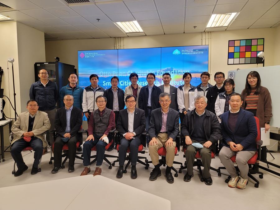
The Hong Kong Polytechnic University (PolyU) set up the Laboratory for Smart City and Spatial Big Data Analytics under the Department of Land Surveying and Geo-Informatics (LSGI) in March 2018 as a platform for academics, industry and government partners to collaborate on smart city solutions. In May 2020, the Otto Poon Charitable Foundation Smart Cities Research Institute (SCRI) was established as a platform for interdisciplinary research in the field. Prof. Shi has taken the helm as the director of both units.
Currently, SCRI brings together over 65 PolyU members including scholars, postdoctoral fellows and research students from the disciplines of construction and environment, engineering, applied science and textiles, health and social science, business, and so on. “At SCRI, members contribute their expertise to interdisciplinary research projects spanning nine themes—High-definition Maps for Autonomous Driving; Connected Environment for Urban Mobility; Smart Positioning and Navigation; Ageing Mobility Analytics; Data Science for Smart Cities; Smart Environment; Smart Living; Smart Government; and Smart Economy.” said Prof. Shi. “These projects are supported by seed funds from the Institute and by external grants, establishing the foundation for larger applications in the future.”
Spatiotemporal prediction of COVID-19 transmission
The concept of “liveable cities” concerns the well-being of humans in relation to their environment. Smart city development should be people-centred. A city must be “safe” in order to be liveable. Recent years have witnessed unprecedented challenges to human safety, as governments around the world have struggled to curb the COVID-19 pandemic. However, Prof. Shi and his team have responded to the public health crisis with speed and agility. Regulatory measures for combating rapid viral transmission rely on important health informatics and epidemiology references. The SCRI team is determined to give a helping hand with their inventions.
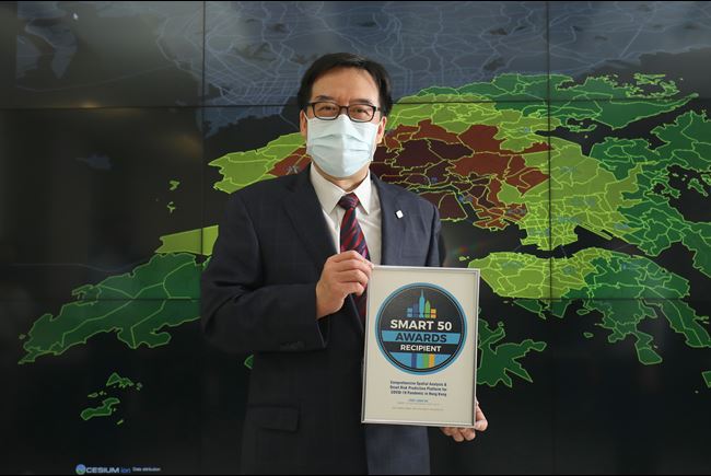
“We have put great research effort into spatial analytics for COVID-19,” explained Prof. Shi. The team has devised several solutions that facilitate pandemic management. “My team developed a series of extended weighted kernel density estimation (E-WKDE) models for short-term prediction of the spatiotemporal COVID-19 symptom onset risk. We also used these models for studying the transmissibility of SARS-CoV-2 Delta and Omicron variants and investigating the efficacy of anti-epidemic measures for Delta and Omicron infections.” The team’s contribution was significant. Dr Gauden GALEA, WHO Representative in China, declared that their findings were “already of great use”, and made their study available to the WHO Western Pacific Regional Office which serves 1.9 billion people in 37 countries.
Building on the established models, SCRI members then developed a mobile application system (funded by the Research Grants Council) which delivers risk predictions and sends active real-time early warnings about high-risk areas or routes to the public. The technology has attracted extensive media coverage, including over 50 local media reports and exclusive interviews in January 2022.
The period from late 2021 to March 2022 was extremely difficult for the Hong Kong community. The city was scathed by the Omicron-driven fifth wave of the pandemic. It paralysed healthcare services, led to over 13,000 deaths, and forced the suspension of classroom teaching in all schools. While the city was struck with fear, SCRI members were working hard to decipher the genetic codes of the virus underlying the rapid infection.
“Prof. Gilman SIU Kit-hang, Professor in the Department of Health Technology and Informatics, used rapid sequencing to identify the viral source for each wave of the pandemic in Hong Kong and the transmission links among confirmed cases,” explained Prof. Shi. “In the fifth wave, Dr Siu identified multiple sources of the wave and associated transmission links, including the Delta variant sublineage induced by pet hamsters. His work has assisted the government in reducing the damage caused by the fifth wave of transmission.” Pet hamsters carrying the variant are believed to have sparked the fifth outbreak, according to genomic sequencing. In January 2022, the Hong Kong government announced a pet hamster cull and a ban on the import of hamsters.
Making transport status visible at a glance: Promoting road safety and smart travel with interoperable, multi-modal maps
At the core of urban informatics are visual maps. Urban mapping uses advanced tools and techniques like remote sensing, geographic information systems, field surveys, and 3D modelling to obtain and analyse spatial data related to urban environments and activities.
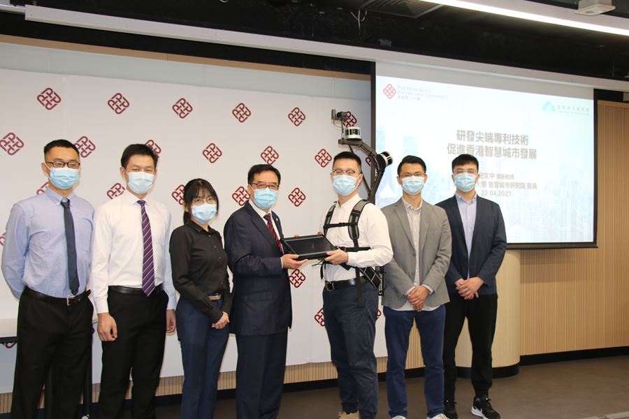
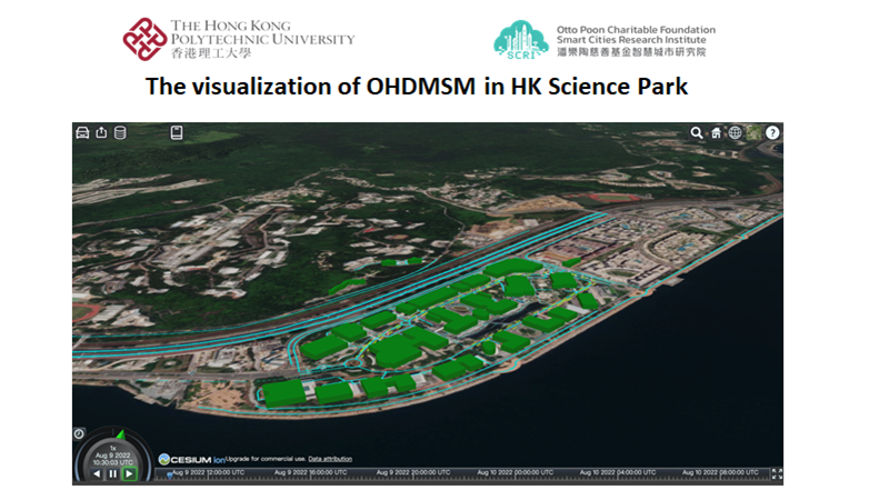
The rapid emergence of autonomous vehicles mean that self-driving is no longer a science-fiction fantasy. However, cases of system failure in these cars and the fact that driverless/autonomous cars cannot fully eradicate crashes point to significant room for improvement. A precise, accurate and responsive map containing rich information for these vehicles is important for road safety. SCRI members have been working on a high-definition (HD) map which contains detailed information about road lanes, traffic lights and relevant static or dynamic features of the road.
“One of our members, Dr LIU Xintao, Associate Professor in the Department of LSGI, is leading a study to design an Open HD Map Service Model (OHDMSM). This HD map is built from three layers of information (i.e., static map, dynamic data, and real-time data). It is highly interoperable (i.e., suitable for different map interfaces) so that feedback from users of Google Maps, OpenStreetMap, and digital topographic maps can be gathered and used for constructing and enhancing the HD map,” explained Prof. Shi.
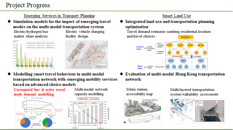
Autonomous vehicles are only one of many emerging modes of transport. As in many other countries, the transportation system in Hong Kong is evolving. It is becoming more complex and multi-modal, particularly after the introduction of electric/hydrogen buses and demand-responsive buses (which provide customised services based on demand rather than on fixed schedules and routes). Prof. Anthony CHEN, Associate Head (Teaching) and Professor in the Department of Civil and Environmental Engineering, is leading a large team in developing advanced modelling and simulation. They seek to understand the effects of these emerging mobility services on combined location and travel choice behaviours. The outcomes will facilitate long-term transportation and land planning (e.g., identifying the best location for a new electric vehicle charging facility).
Mapping microclimate: Preventing heatstroke in the elderly
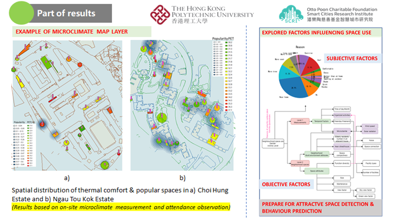
The knowledge built from mapping technologies enables valuable applications in a wide range of areas. For example, heat stress in older adults can cause disability and mortality. In high-density cities with hot, humid weather like Hong Kong, the risk of heat stroke is high, especially during summer. Ir Prof. NIU Jianlei, Associate Director of SCRI and Chair Professor of Building Environment and Energy in the Department of Building Environment and Energy Planning, and Prof. CHEN Wu, Head of the Department of LSGI, are leading a project to build a map that will integrate the behaviour of elderly people and the microclimate in public housing estates. The map will help identify specific areas that are thermally comfortable and suitable for activities, as well as areas that require cooling.
“This project provides a guide for urban design that responds to the needs of the elderly under global warming and population ageing. It improves the design of neighbourhood spaces for age-friendly communities, and enables real-time detection of suitable spaces for healthy activities among the elderly.” explained Prof. Shi.
Leading with science towards excellence and better living
The first triennial cycle of SCRI is complete, and the Institute has overachieved its three-year strategic development goals under Prof. Shi’s leadership. In the 2022/23 year, the Institute published over 30 journal papers listed in the Science Citation Index and Social Sciences Citation Index. It has also been awarded a cumulative total of HK$95 million in external grants, which is over 2.5 times the three-year funding target.
Several inventions at SCRI have been recognised by prestigious awards in the local and international arenas. The 3D Mobile Mapping System—a lightweight, mobile mapping backpack for obtaining 3D maps with centimetre-level accuracy in high-density and complex urban environments—was awarded the 2021 Research Team of the Year by the Royal Institution of Chartered Surveyors Awards Hong Kong. The Interactive Platform for COVID-19 Status and Risk Prediction, mentioned above, won the Outstanding One-stop Virus Decision Support Platform (HealthTech) Award in the ETNet Smart Living Partnership Awards 2022. More recently, the Advanced Real-time Prediction and Early Warning System for the Spread of Emerging Pathogens led by Prof. Shi received a Gold Medal at the 48th International Exhibition of Inventions of Geneva.
Apply information for better living, share information for better urban informatics
Urban informatics is the interdisciplinary study of the intersection of people, place and technology, i.e., the social, spatial and technology domains in society. This area of study is relatively new to many of us. However, Prof. Shi is a pioneer, having embarked on the field in 2013. He received his doctoral degree in geomatics from the University of Osnabrück, Vechta, Germany, in 1994, and conducted research across a wide range of areas like smart cities, geographic information science and remote sensing, and applications such as satellite imagery, mobile mapping and 3-D modelling. Prof. Shi is among the Top 2% Cited Researchers according to 2022 lists published by Elsevier BV and Stanford University.
Over the years, Prof. Shi has been actively creating and transferring new knowledge in the field of urban informatics. “The short-term goal of my work is to develop new technologies for supporting the development of smart and sustainable cities,” said Prof. Shi. “In the long run, my team and I strive to transfer our technologies to practice, and to promote the development of urban informatics in academia and society.” The pioneering scientist is currently the President of the International Society for Urban Informatics and the Editor-in-Chief of international journal Urban Informatics—the first international open access journal in the field.
A firm belief in knowledge has driven his contribution to a plethora of publications. “Rapid publications, especially through open access journals, are an effective way of communicating within academia,” said Prof Shi. “This journal will help accumulate the knowledge for this emerging field, and further stimulate the development and application of urban informatics by worldwide scholars and professionals, thereby equipping cities with better sustainability.” The scholar has published over 300 research articles in journals indexed by Web of Science, as well as 20 books. He has also had over 40 patents granted.
Prof. Shi’s dedication to the field as a researcher-inventor has been recognised by many prestigious national and international awards. Among these honours, he has won the National Natural Science Award (Second-class) from the State Council of China (2007), the Science and Technology Progress Award in Surveying and Mapping (Grand Award) from the Chinese Society for Surveying, Mapping and Geoinformation (2017), and the Distinguished Scholar Award (Service) from the International Association of Chinese Professionals in Geographic Information Sciences (2021).