- Research Area
- 3D Mapping Aided GNSS Positioning
- Perceived Aided Sensors Integrated Navigation (PASIN) Scheme
- Realization of Low-Speed Autonomous Ground Vehicle
- GNSS Vector tracking in urban canyons
- Multi-sensors integrated navigation system for autonomous driving
- Collaborative Positioning for IoT in Smart Cities
- Positioning Integrity Monitoring for autonomous driving vehicle
3D Mapping Aided GNSS Positioning
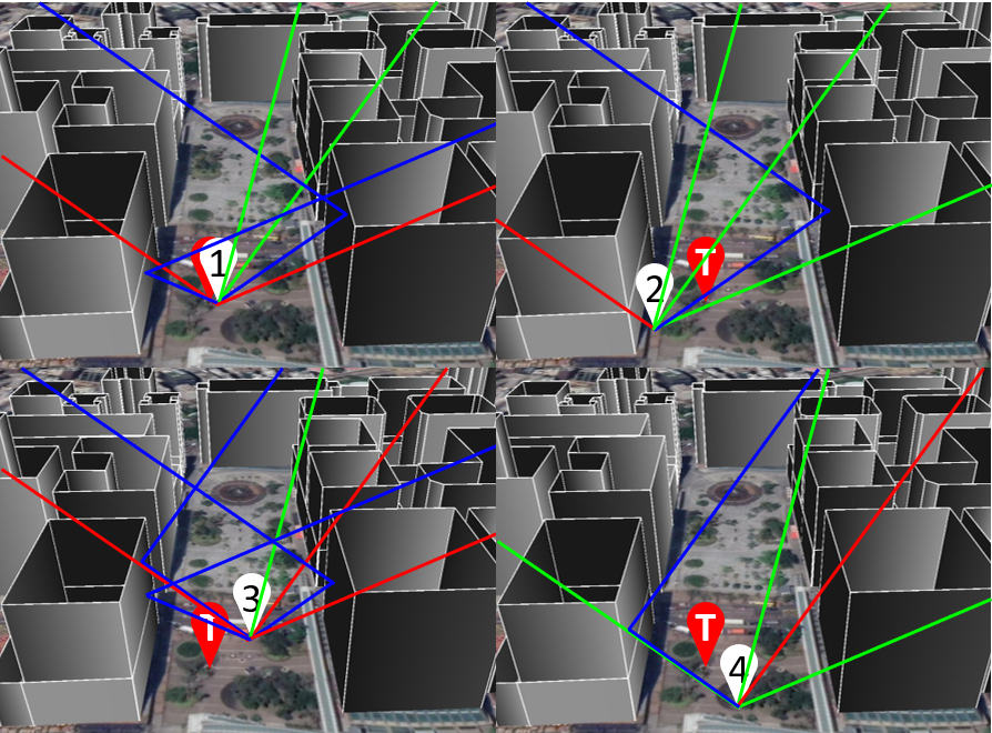
The 3D mapping-aided (3DMA) GNSS integrates the information provided by the 3D building model. Once the surrounding building model is presented, the visibility of the satellites can be predicted, which also known as Shadow Matching to match the received satellites with the predicting by 3D building model. The more advanced one is using the 3D model to predict the reflecting path and its delay, which are ray-tracing based GNSS ranging and Skymask 3DMA ranging methods. We developed the Skymask 3DMA ranging to reduce the computation load compares to the ray-tracing based GNSS while maintaining the positioning accuracy. The advantage of 3DMA GNSS is providing positioning accuracy for the low-cost receivers up to about five meters in dense urban areas.
Researcher : Dr Guohao ZHANG (Research Assistant Professor);
Mr Ivan Hoi Fung NG (Ph.D Student);
Mr Haosheng XU (Ph.D Student)