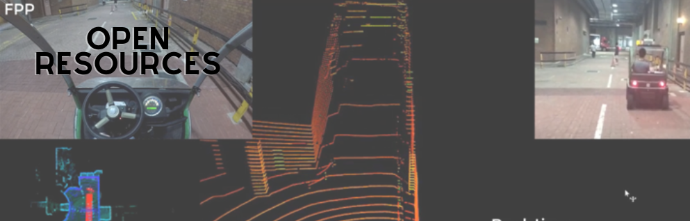
Open Resources
UrbanNav

UrbanNAV

An Open-Sourcing Localization Dataset Collected in Asian Urban Canyons, including Tokyo and Hong Kong

Under development and approval by IAG (International Association of Geodesy) and ION (Institute of Navigation).
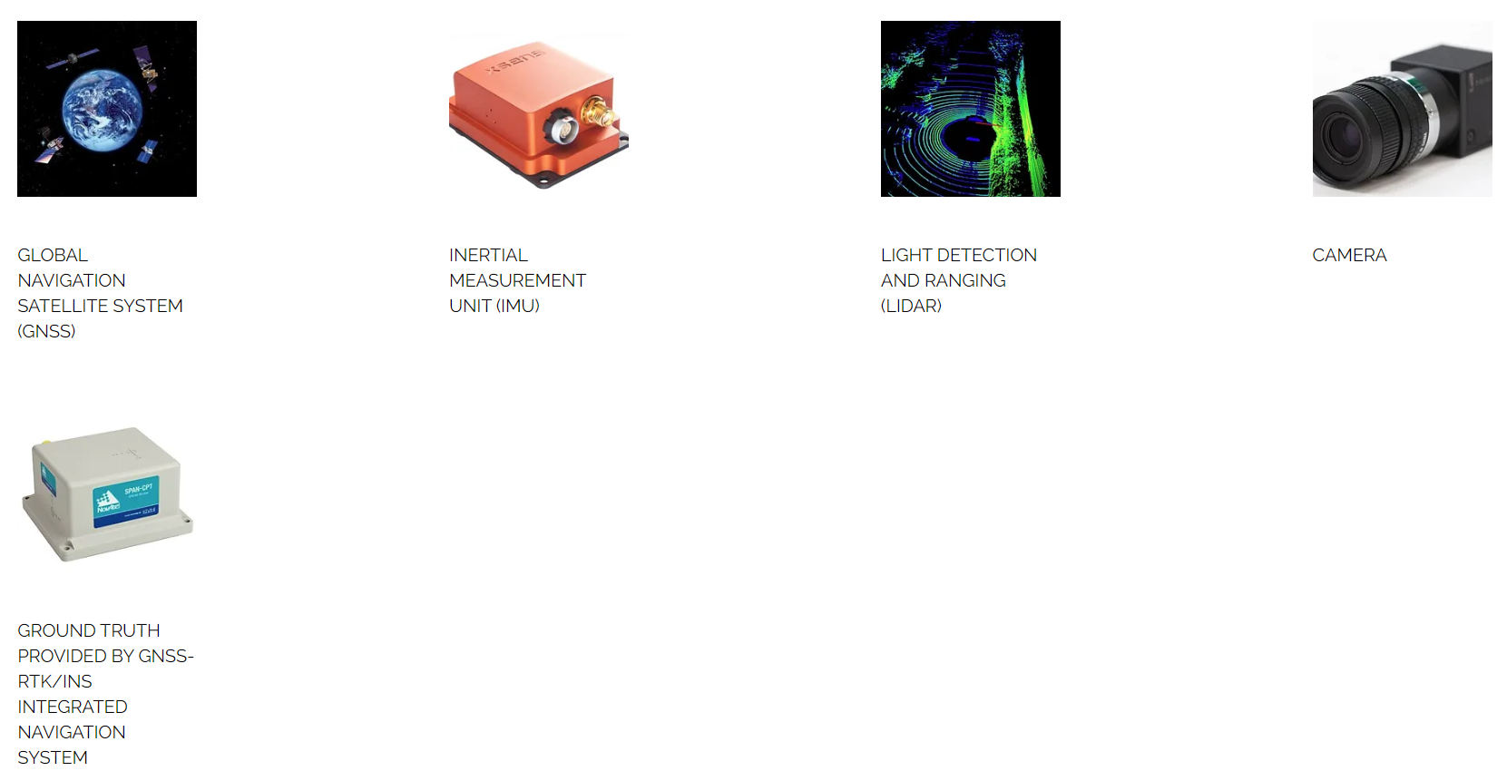
Positioning and localization in deep urban canyons using low-cost sensors is still a challenging problem. The accuracy of GNSS can be severely challenged in urban canyons due to the high-rising buildings, leading to numerous Non-line-of-sight (NLOS) receptions and multipath effects. Moreover, the excessive dynamic objects can also distort the performance of LiDAR, and camera. The UrbanNav dataset wishes to provide a challenging data source to the community to further accelerate the study of accurate and robust positioning in challenging urban canyons. The dataset includes sensor measurements from GNSS receiver, LiDAR, camera and IMU, together with accurate ground truth from SPAN-CPT system. Different from the existing dataset, such as Waymo, KITTI, UrbanNav provide raw GNSS RINEX data. In this case, users can improve the performance of GNSS positioning via raw data. In short, the UrbanNav dataset pose a special focus on improving GNSS positioning in urban canyons, but also provide sensor measurements from LiDAR, camera and IMU. You can download the data from https://github.com/IPNL-POLYU/UrbanNavDataset . If you got any problems when using the dataset and cannot find a satisfactory solution in the issue list, please open a new issue on Github and we will reply ASAP.
Key words: Positioning, Localization, GNSS Positioning, Urban Canyons, GNSS Raw Data,Dynamic
Related Papers:
  • Wen, W., Pfeifer, T., Bai, X., & Hsu, L. T. (2021). Factor graph optimization for GNSS/INS integration: A comparison with the extended Kalman filter. NAVIGATION, Journal of the Institute of Navigation, 68(2), 315-331. https://doi.org/10.1002/navi.421
  • Wen, Weisong, Xiwei Bai, Li-Ta Hsu, and Tim Pfeifer. "GNSS/LiDAR Integration Aided by Self-Adaptive Gaussian Mixture Models in Urban Scenarios: An Approach Robust to Non-Gaussian Noise." In 2020 IEEE/ION Position, Location and Navigation Symposium (PLANS), pp. 647-654. IEEE, 2020. https://doi.org/10.1109/PLANS46316.2020.9110157
  • Zhang, Jiachen, Weisong Wen, Feng Huang, Xiaodong Chen, and Li-Ta Hsu. 2021. "Coarse-to-Fine Loosely-Coupled LiDAR-Inertial Odometry for Urban Positioning and Mapping" Remote Sensing 13, no. 12: 2371. https://doi.org/10.3390/rs13122371
  • Huang, Feng, Weisong Wen, Jiachen Zhang and L. Hsu. “Point wise or Feature wise? Benchmark Comparison of Public Available LiDAR Odometry Algorithms in Urban Canyons.” IEEE Intelligent Transportation Systems Magazine (accepted), 2021.
  • Li, Tao, Ling Pei, Yan Xiang, Qi Wu, Songpengcheng Xia, Lihao Tao, and Wenxian Yu. "P3-LOAM: PPP/LiDAR Loosely Coupled SLAM with Accurate Covariance Estimation and Robust RAIM in Urban Canyon Environment." IEEE Sensors Journal (2020). paper
  • Chen, Chao, and Guobin Chang. "PPPLib: An open-source software for precise point positioning using GPS, BeiDou, Galileo, GLONASS, and QZSS with multi-frequency observations." GPS Solutions 25, no. 1 (2020): 1-7. PPPLib Code, paper
  • Li, Kailai, Meng Li, and Uwe D. Hanebeck. "Towards high-performance solid-state-lidar-inertial odometry and mapping." IEEE Robotics and Automation Letters 6.3 (2021): 5167-5174.
  • Wen, Weisong, Guohao Zhang, and Li-Ta Hsu. "Exclusion of GNSS NLOS receptions caused by dynamic objects in heavy traffic urban scenarios using real-time 3D point cloud: An approach without 3D maps." Position, Location and Navigation Symposium (PLANS), 2018 IEEE/ION. IEEE, 2018.
  • Wen, W.; Hsu, L.-T.*; Zhang, G. (2018) Performance analysis of NDT-based graph slam for autonomous vehicle in diverse typical driving scenarios of Hong Kong. Sensors 18, 3928.
  • Wen, W., Zhang, G., Hsu, Li-Ta (Presenter), Correcting GNSS NLOS by 3D LiDAR and Building Height, ION GNSS+, 2018, Miami, Florida, USA.
  • Zhang, G., Wen, W., Hsu, Li-Ta, Collaborative GNSS Positioning with the Aids of 3D City Models, ION GNSS+, 2018, Miami, Florida, USA. (Best Student Paper Award)
  • Zhang, G., Wen, W., Hsu, Li-Ta, A Novel GNSS based V2V Cooperative Localization to Exclude Multipath Effect using Consistency Checks, IEEE PLANS, 2018, Monterey, California, USA. Copyright (c) 2018 Weisong WEN
  • Sensor include:
     
    BACK TO TOP