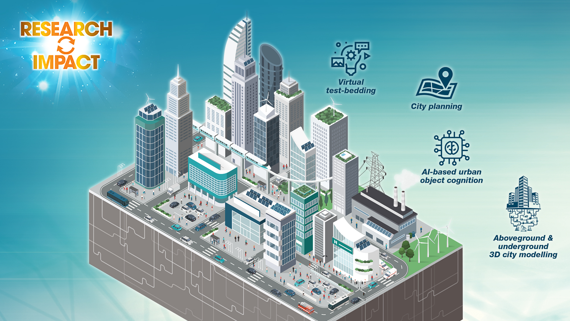
Incorporating patented technologies of 3D city modelling, AI-based urban object cognition, as well as spatial big data analytics and visualisation, the Smart City Platform can be used to acquire and process massive urban spatial information, 3D LiDAR data, and multiscale image data to create high-precision and realistic smart city data infrastructure. The platform supports various smart city applications to aid governmental policy making, environmental management, transport optimisation, citizen services, etc. Latest developments of the platform include:
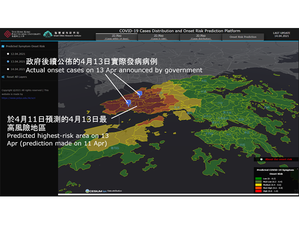
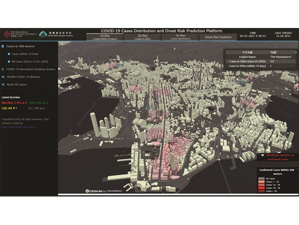
- A model, which was published internationally, for predicting the COVID-19 symptom onset risk in 7 days in 291 Territory Planning Units in Hong Kong;
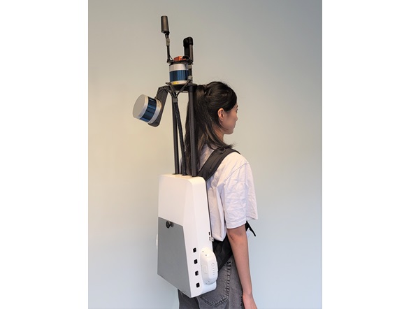
- A lightweight 3D spatial data acquisition system that can be used in outdoor and indoor 3D city modelling, construction of Building Information Models (BIMs), and urban renewal;
- A series of artificial intelligence technologies to recognise buildings, roads and other urban objects. The technologies have
been applied to landslide recognition in Hong Kong to support governmental disaster mitigation.