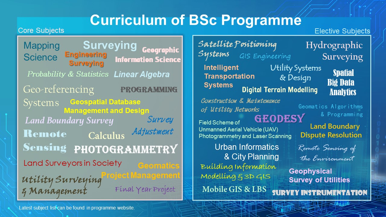
Curriculum
The programme curriculum enables students to develop all-round skills and to be ready for professional careers through subjects related to the land/utility surveying and geo-informatics industry and subjects related to languages, ethics and global engagement. Compulsory subjects are offered every year and in progressive patterns, whereas a group of elective subjects are offered. This combination of compulsory and elective subjects equips students with the knowledge and skills needed to comprehend basic and advanced technologies. These include basic surveying, positioning and navigation skills and advanced 3D mapping, modelling, visualisation skills related to the analysis of terrain, infrastructure, buildings, underwater environments, the underground world and even other planets, with emphases changing over time. Graduates are equipped with the highest caliber to pursue professional career and further education upon the two years of study.