Here’s a dilemma faced by all owners-to-be shopping for an apartment off-plan – it’s usually cheaper off-plan, but you don’t know what the view is like. As the property isn’t built yet, you can only guesstimate by taking into account the direction and the height of an apartment. No matter how imaginative you are, you still have to allow for some disappointment – a building that doesn’t bug you on ground level may seem grossly unsightly from up high. However, with the precise 3D mapping model developed by Dr Bo Wu, Associate Professor, Department of Land Surveying and Geo-Informatics, and his research team, not only can you visualize the exact view from the living room of an apartment that does not exist yet, but also earn insights on the sunlight and ventilation it gets throughout the day. The same model was used to map the landing site in Chang’e-3 lunar exploration mission by the China National Space Administration (CNSA) and will be used in the upcoming Chang’e-5 and Mars missions.
The importance of 3D mapping
With the function of GPS and online 2D maps available in smartphones, most urbanites and motorists have found themselves using such navigating tools at one time or another. A vertical dimension is added to 3D maps which are essential for landing of spacecraft on celestial bodies and for determining the environment impact in town planning, according to Dr Wu. “Mapping the topography of a celestial body is crucial to space expeditions for picking a landing spot. In terms of urban planning, we need to know the shapes and dimensions of landscape features and architecture in an area before planning what infrastructure or buildings should be erected, while making the least sacrifice to the livability of a city,” he said.
Less error, higher accuracy
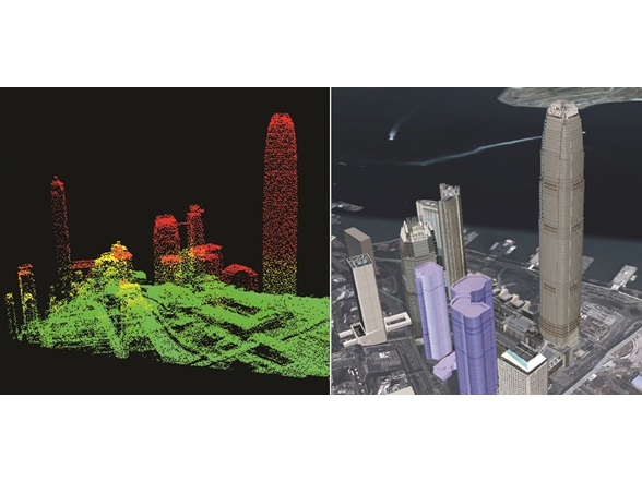
There are basically two ways for 3D mapping. First off, photogrammetry measures the position, orientation, shape and sizes of objects from photographs. It’s not unlike the stereoscopic effect of red-green 3D glasses. When two photos of the same scene is taken from two different angles, the spatial relationship between objects in the scene can be calculated. The second method involves 3D laser scanning. A running laser beam is emitted by a laser sensor. It touches the ground surface and is then reflected. The sensor receives the reflected laser beam and records the time it takes to travel back, so as to determine the distance.
However, both technologies have their own weaknesses. Photogrammetry shows better accuracy on horizontal measurements whereas laser scanning is more accurate in measuring vertical distances. When datasets are collected from different sources with different technologies, the discrepancies can be as much as a few hundred metres. “In determining the topography of the moon for instance, satellite imagery and laser scanning data may differ by 800 m in vertical measurement and by 4.8 km in horizontal measurement. If a robotic lander lands on the wrong spot, say, the edge of a crater, it might fall and ruin itself. That’s why we developed an automated system to calibrate, register and analyse multi-source datasets, in a view to remove the errors and maximize the accuracy of the simulated topography,” said Dr Wu.
“After mapping a place, we can create 3D models of the place and analyse how air current flows around structures, how sunlight hits a building, and even what can be seen from a certain position at a certain height. This information would be very useful for property buyers-to-be to make informed decisions. In fact, for smart city development, our model can simulate the end results before erecting any structure on the site, so that a balance can be made between development and quality of life.”
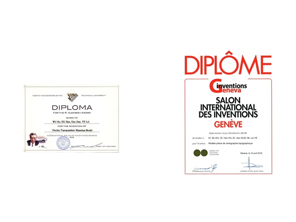
In April 2016, the model won a gold medal and a special merit award in the 44th International Exhibition of Inventions of Geneva, Switzerland.