Skip to main content Start main content

Photogrammetry and Robotic Vision Laboratory (ZB225)

banner

Research Focus Area: Planetary Remote Sensing and Mapping, Planetary Science

Location : ZB225
Space: 40 m2

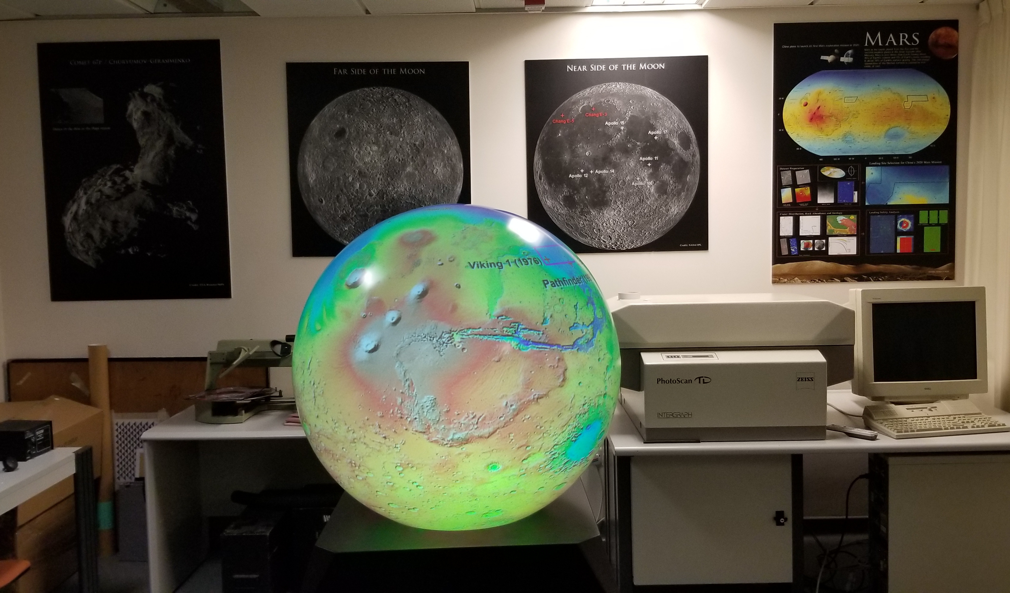
The Planetary Remote Sensing Laboratory (PRSLab) focuses on interdisciplinary research in the areas of planetary mapping, remote sensing, geomorphology, and geology. The PRSLab houses specialist equipment including photogrammetric workstations, spectrometers, and imaging simulation and calibration facilities to support various types of research tasks. The PRSLab has been working on topographic, geomorphological, and geological mapping and characterization of planetary surfaces over the past decades. The research results have been extensively used to support landing site mapping and evaluation in various exploration missions to the Moon and Mars.

The specialist equipment space houses an Intergraph ImageStation DPW, an Intergraph PhotoScan TD, a dual screen Leica LPS DPW, a Peiss P3 analytical stereo plotter, and provides a workspace for laser scanning projects. The Lab is also equipped with instruments and sensors for advanced research and development in photogrammetry and robotic vision, and a demonstration platform for planetary mapping and remote sensing research.

Lab-in-charge: Prof. Bo WU (bo.wu@polyu.edu.hk)


Research Output

Planetary Mapping

Innovative photogrammetric techniques were developed for Lunar and Mars mapping.

Dust Storm Monitoring System

Dust Storms are caused by strong and turbulent winds entraining particles of dust into the air. The retrieval of dust aerosols over a whole region is challenging because the spatial and temporal variations of dust aerosols are difficult to depict.

High Resolution Thermal Helicopter-borne Measurements

Thermal satellite images are of low spatial resolutiona nd only record temperatures of horizontal surfaces such as the ground and rooftops. To obtain more spatial detail, and record both horizontal and vertical surfaces, the first ever helicopter-borne thermal survey was conducted on August 8, 2013.

Photogrammetric Equipment

The Photogrammetry and Remote Sensing Lab is equipped with a range of photogrammetric, laser scanning and remote sensing hardware and software packages.

Functional Models for Camera Arrays

Conventional functional models for multi_camera arrays describe the relationships between the cameras in terms of approximate constraints.

Reflective Laser Scanning

The exploitation of the reflective properties of materials to enhance the scope of terrestrial laser scanners. Visible surfaces are scanned directly, whereas inaccessible surfaces are scanned via the judicious use of a reflective surface.

Underground Railway Laser Scanning

Underground railways play a significant role in Hong Kong's daily life. To ensure continuity of service, tunnel hardware including the tracks, power supply, signalling, tunnel lining and embedded infrastructure should be continually monitored.

Asymmetric photogrammetry

A dual-camera system with an asymmetric photogrammetric configuration was developed for enhanced vision capabilities.

Your browser is not the latest version. If you continue to browse our website, Some pages may not function properly.

You are recommended to upgrade to a newer version or switch to a different browser. A list of the web browsers that we support can be found here