

Pillar lead: Li-Ta Hsu
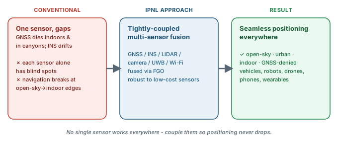
We build navigation systems for real platforms — vehicles, robots, drones, smartphones, wearables. These require tight GNSS/INS/LiDAR/camera/UWB/Wi-Fi fusion, robustness to low-cost sensors, and seamless operation across open-sky, urban canyon, indoor, and GNSS-denied conditions.
The thread spans smartphone-grade urban positioning (3DMA GNSS for L5/E5a/B2a smartphone receivers; ITF-ITSP HK$801k AI-aided Smartphone Urban Positioning for HK Smart Cities), autonomous-vehicle perception integration (LiDAR + camera + GNSS + INS), UAV navigation (Limin Endowed Young Scholar in Aerospace Navigation), and indoor positioning anchored by the 2026 Artech House book Principles of Indoor Positioning and Indoor Navigation (Hsu, Zhang, Wen) and IPIN 2024 General Chair role.
Funded projects. The ITF-ITSP smartphone-positioning project completed its funded period in May 2026. A new RIAIoT Seed Fund award for road-to-parking vehicle positioning was approved in September 2026, supporting research on multimodal fusion across outdoor and covered-parking transitions.
Lab Contributors
Related Projects
- Multi-Agent Collaborative GNSS for Intelligent Transportation Systems completed
- Stairio: Autonomous Staircase Safety Monitoring Robot active
- UrbanNav active
- LunaNav: Lunar Robotic Exploration funding-completed
- Robust GNSS Navigation for Urban Air Traffic Management active
- UrbanLoco maintained
- GraphGNSSLib active
- Universal Vehicle Self-Diagnosis: Predictive Component Monitoring active
- 3D Map-Aided GNSS (3DMA) for Smartphone and IoT active
- Environment-Aware GNSS for UAS and Autonomous Driving active
- Seamless Vehicle Positioning Across Road-to-Parking Transitions awarded