The design of this tool stemmed from a previous Project under UGC (“Learning-to-Learn”). The original tool was designed to engage students to link learnt theories with actual use, within this Project the aim is the same but the targets are different. The modified tool aims to address the issue with Incoming Foundation and Reinforcing Study in Students by enabling both Students and Educators to guide them into thinking scientifically, professionally, and in the Educators’ think in the shoes of the Students, on how to help structure the Students’ thoughts and outcomes.
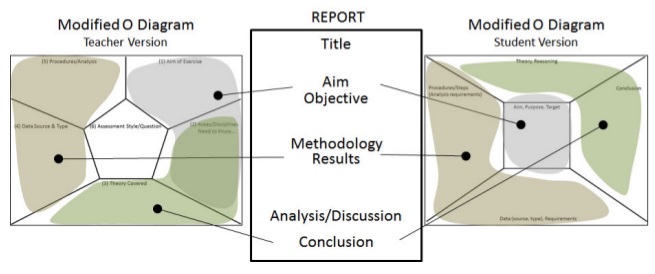
2 versions are designed for this, Student version and Teacher version. (Click heading for Material, refer to Geospatial ‘O’ Diagram GUIDE for how to use).
TEACHER VERSION
Aims to help Educators in identifying the various elements they wish to assess, become aware of the connections between their assessments with other disciplines, and to provide an alternative to grading rubrics where Educators can compare knowledge with intentions.

STUDENT VERSION
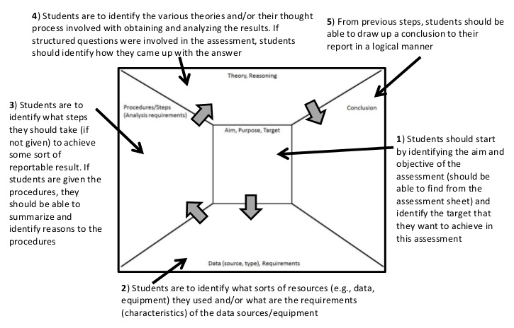
Aims to help students structure their reports and submissions, to better articulate their understanding and thoughts, and to improve and standardize reports and submissions.
Geospatial “O” Diagram: Teacher Version
Geospatial “O” Diagram: Student Version
Geospatial ‘O’ Diagram GUIDE