The two major traditional 3D mapping techniques are photogrammetry using satellite/aerial imagery and laser scanning. The former offers higher accuracy in the horizontal direction while the latter shows higher accuracy in vertical direction. They may produce errors at different levels and there are usually inconsistences between the mapping products derived from them.
To eliminate data errors and integrate the advantages of the existing technologies, Prof. Wu Bo at PolyU’s Department of Land Surveying and Geo-Informatics developed a “Novel Integrated 3D Mapping Model”. Integrating multi-platform satellite/aerial imagery and laser scanning data, the technology greatly improved the accuracy in mapping products by 26-66% to centimetre level.
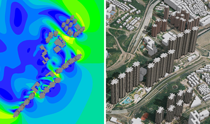
The cost of the mapping products produced by this model is more or less the same as the satellite imagery. This new technology allows monthly updates and handling of massive data and can cater for the needs in the big data era. It can be used in topographic mapping and 3D modelling of cities for smart city development. For example, it is particularly useful in analysing ventilation, visibility and sunlight distribution between buildings.
The invention won a Gold Medal and Special Merit Award from the Nizhny Novgorod State Technical University, Russia, at the 44th International Exhibition of Inventions of Geneva.