
Hong Kong, a high-density urban city with tropical climate and many high-rises, suffers from the “Urban Heat Island” effect. In this issue, Dr Charles Wong Man-sing at the Department of Land Surveying and Geo-Informatics shared his views on mitigating “Urban Heat Island” effect.
Why does Urban Heat Island (UHI) effect exist in Hong Kong?
“Urban Heat Island” (UHI) occurs in a densely populated area, like Hong Kong, with higher temperature than surrounding rural areas. In urban development, the changes of land use, the densely urban infrastructure and anthropogenic heat cause the lower cooling effect in built-up areas, resulting in large temperature difference.
What are the factors relevant to UHI?
The “Sky View Factor (SVF)” is one of the factors indicating the relationship between urban geometry and city wind ventilation as well as temperature. SVF is defined as the fraction of sky visible from the ground up. Open space gives higher SVF, meaning better heat release at night.
Besides building geometry, the height and density of the buildings also affect temperature and air flow. Other factors relevant to UHI are wind direction and speed, vegetation cover, man-made heat sources and air-borne pollutants.
How does UHI affect the wellbeing of urban dwellers in Hong Kong?
At the peak of summer in Hong Kong, every degree-Celsius rise in temperature results in several more deaths associated with excessive heat exposure. UHI also exacerbates heat waves, increases the risks of heat stroke and exhaustion, especially among those with chronic diseases and working outdoors.
Are there ways to reduce UHI effect?
Yes. Vegetation cover and using proper building materials can help reduce UHI effect. More importantly is better town planning based on data gathered with Remote Sensing technologies and Geographic Information Systems (GIS).
With these technologies, we can derive ventilation pathways by mapping out the Frontal Area Index (a ratio of total area of the building facets exposed to the wind) of each building retrieved from GIS data and deducing the paths of least air flow resistance. This facilitates town planners to make better decisions in environmental design without blocking the key ventilation corridors. Ventilation can thus be maintained and UHI effect be mitigated.
Please explain your research in mitigating UHIs.
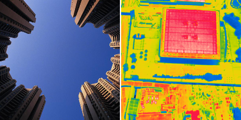
Our research team overviewed the temperatures in Hong Kong illustrated by satellite and aerial images recorded for the last twenty years. Through helicopter-borne thermography and three-dimensional thermal models, we also analyzed how building designs, materials and planning practices affect the formation of UHIs.
And now, we are developing a portable environmental monitoring device that can be connected to a smartphone via Bluetooth. Geo-tagged data generated from the device can then be uploaded to a server for real-time sharing and visualization.
We are happy to see that, in the near future, everyone can contribute to the real-time report of various environment attributes, including temperature, humidity, ultraviolet (UV), noise and air pollution from anywhere in Hong Kong, in order to facilitate the development of a “Smart City”.